
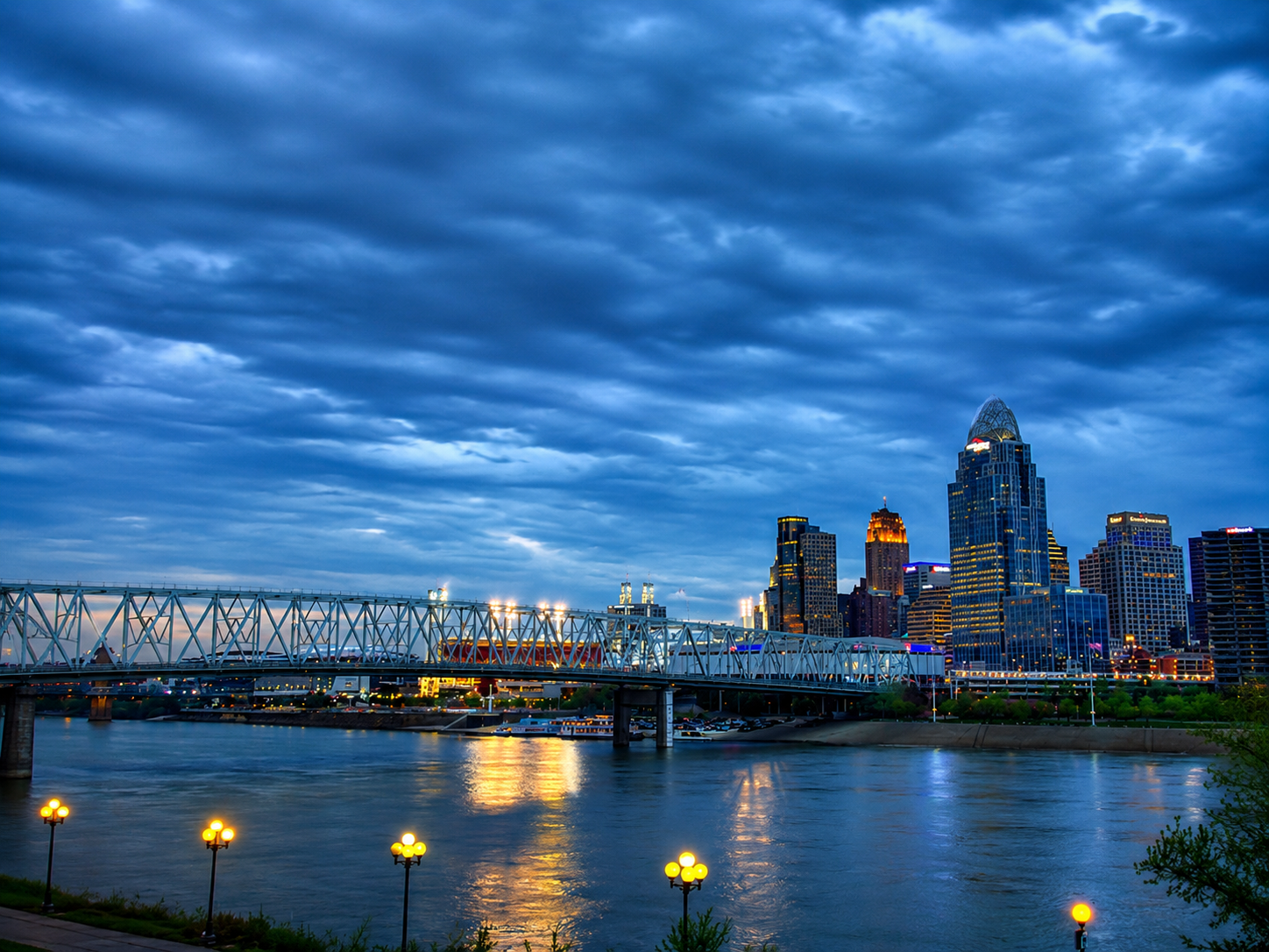
Ohio River: Cincinnati’s Defining Geographic Feature
The Ohio River is one of the most consequential waterways in American history — a 981-mile river system that forms the southern boundary of Ohio, Indiana, and Illinois while defining the northern edge of Kentucky and West Virginia along its course from Pittsburgh to Cairo, Illinois where it empties into the Mississippi.
For Cincinnati, the Ohio River is more than a geographic boundary — it is the reason the city exists where it does, the engine of its early commercial prosperity, and the physical feature that has shaped its urban form, cultural identity, and regional relationships across more than two centuries of continuous development. For Hamilton County residents, property owners along the riverfront, and anyone seeking to understand what makes Cincinnati distinct among American cities, the Ohio River’s geography and its relationship to the city represents an essential starting point.
Glacial Origins and the River’s Geographic Formation
The river’s formation traces to the retreat of the Laurentide Ice Sheet — the massive glacial system that covered much of North America during the last ice age — whose meltwater carved and established the Ohio River’s course through the Appalachian Plateau and the Interior Lowlands of the American Midwest approximately 10,000 to 12,000 years ago.
This glacial origin gives the Ohio River its characteristic broad, meandering channel and the relatively flat floodplain — the low-lying land adjacent to a river that is subject to periodic flooding — that made the Cincinnati basin an attractive location for both Indigenous settlement and European colonial development during the late eighteenth century.
The Miami and Erie Tribes understood this geography long before European settlers arrived, establishing communities along the river corridor that recognized the same transportation and subsistence advantages that would later attract American settlers to the same locations.
The Ohio River and Cincinnati’s Commercial Origins
Cincinnati’s emergence as one of the most important inland commercial cities in early nineteenth century America was inseparable from its position on the Ohio River. The river provided the city with reliable water transportation connections to the Mississippi River system and ultimately to New Orleans and the Gulf of Mexico — a commercial network that allowed Cincinnati to export the agricultural products, manufactured goods, and processed food products of the Ohio Valley to national and international markets before the railroad era transformed American transportation geography.
This commercial advantage made Cincinnati the largest city west of the Appalachians by 1810 and sustained its growth through the antebellum period as the city developed the meatpacking, machinery manufacturing, and consumer goods industries that earned it the nickname Porkopolis — a reference to the enormous hog processing operations that made Cincinnati the center of American pork production during the 1840s and 1850s.
The steamboat era amplified this commercial advantage dramatically. The development of reliable steam-powered river navigation in the early nineteenth century transformed the Ohio River from a one-directional current that favored downstream movement into a two-directional commercial highway that connected Cincinnati to suppliers and markets both upstream and downstream with equal reliability.
The Ohio History Connection documents the river’s archaeological and historical significance within the broader context of Ohio’s development, preserving the evidence of human activity along the Ohio River corridor that spans thousands of years of continuous occupation and use. The civic infrastructure that Cincinnati built on the foundation of this river commerce remains visible today — Fountain Square at the heart of downtown reflects the wealth and civic ambition that Ohio River trade generated during the city’s commercial peak in the nineteenth century.
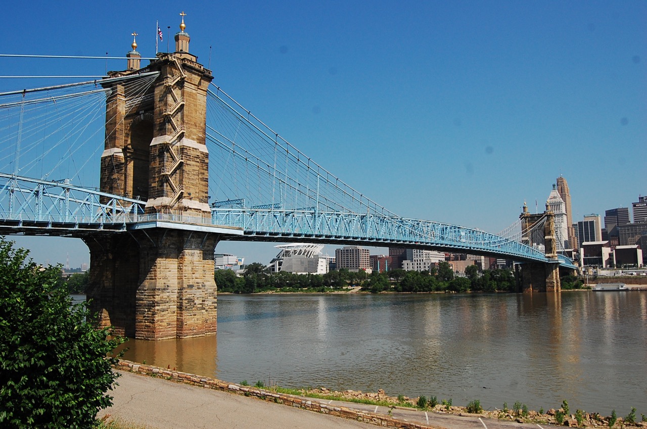
Image Credit: Blbrett, CC BY-SA 4.0, via Wikimedia Commons

River Hydrology and Hamilton County’s Flood Geography
The Ohio River’s hydrology — the study of its water movement, flow patterns, and flood behavior — shapes Hamilton County’s built environment and land use patterns in ways that residents experience most acutely during the flood events that periodically affect Cincinnati’s riverfront neighborhoods and infrastructure. The Ohio River’s watershed covers approximately 204,000 square miles across fourteen states, collecting precipitation from a vast drainage basin that includes portions of the Appalachians, the Ohio Valley, and the upper Midwest.
When significant rainfall or rapid snowmelt occurs across this drainage basin simultaneously, the resulting runoff concentrates in the Ohio River’s channel and can raise water levels at Cincinnati by 50 feet or more above low-water stage — a flood magnitude that overwhelmed the city’s riverfront neighborhoods repeatedly throughout the nineteenth and early twentieth centuries.
The 1937 Ohio River flood remains the defining hydrological event in Cincinnati’s modern history — a catastrophic inundation that covered most of the city’s river basin neighborhoods, displaced hundreds of thousands of residents across the Ohio Valley, and prompted the federal flood control investments that have shaped river management across the region ever since.
According to NOAA’s Advanced Hydrologic Prediction Service, the Cincinnati river gauge at the Roebling Bridge monitors water levels continuously, providing the real-time flood forecasting data that Hamilton County emergency managers use to coordinate flood response and that riverside property owners rely on to protect their investments during high-water events.
The Roebling Suspension Bridge and River Crossings
The physical infrastructure connecting Cincinnati to the Kentucky communities directly across the Ohio River represents one of the most significant engineering achievements in the region’s history — a network of bridges whose development transformed the river from a barrier separating communities into a corridor connecting them.
The John A. Roebling Suspension Bridge, completed in 1866 and spanning the Ohio River between Cincinnati and Covington, Kentucky, holds a specific historical significance that extends well beyond its local function as a river crossing. Designed by John Augustus Roebling — the same engineer who subsequently designed the Brooklyn Bridge in New York — the Roebling Bridge served as the prototype that proved the structural principles and construction methods that Roebling would apply at larger scale to the Brooklyn Bridge project, making Cincinnati’s river crossing a foundational episode in the history of American engineering.
The bridge’s continued operation as a functional crossing more than 150 years after its completion reflects both the quality of Roebling’s original engineering and the sustained maintenance investment that has kept the structure viable through successive generations of transportation technology.
The National Register of Historic Places recognizes the Roebling Bridge’s architectural and engineering significance, placing it within the federal historic preservation framework that governs how the bridge’s character-defining features — the cable suspension system, the stone towers, and the deck structure — may be maintained and modified over time.
Cincinnati’s Riverfront and Urban Development
The transformation of Cincinnati’s Ohio River waterfront from industrial corridor to mixed-use urban amenity represents one of the most visible and consequential urban development stories in the city’s recent history.
The industrial and commercial waterfront that defined Cincinnati’s riverfront for the first century and a half of the city’s existence — characterized by warehouses, rail yards, manufacturing facilities, and the working infrastructure of a commercial river port — has given way over the past three decades to a substantially different land use pattern anchored by Paul Brown Stadium, Great American Ball Park, the National Underground Railroad Freedom Center, and the mixed-use development that has concentrated in the blocks between downtown Cincinnati and the river’s edge.
This riverfront transformation reflects both the national pattern of post-industrial waterfront redevelopment that has reshaped urban riverfronts across American cities and the specific civic investment decisions that Cincinnati has made through successive planning and development efforts aimed at reconnecting the city’s downtown to its defining geographic feature.
Cincinnati’s green spaces reinforce this same civic investment philosophy — Eden Park on the city’s hillside above the river and the Cincinnati Zoo and Botanical Garden represent the cultural and natural amenities that developed alongside the river commerce that funded them, together forming the civic landscape that makes Hamilton County one of Ohio’s most livable metropolitan areas.
The Ohio River’s Environmental Character and Regional Ecology
The Ohio River ecosystem supports a biological diversity that its heavily industrialized history might not suggest — a river system that, despite more than two centuries of commercial and industrial use, retains significant ecological value as a freshwater corridor connecting the Appalachian foothills to the Mississippi River basin.
The river’s fish community includes more than 150 species, making it one of the most biologically diverse river systems in the temperate eastern United States, and the U.S. Fish and Wildlife Service manages protected habitat along the Ohio River corridor that preserves critical aquatic and riparian ecosystem functions alongside the heavily developed reaches that characterize the Cincinnati metropolitan section of the river. Hamilton County’s climate reinforces the Ohio River’s ecological significance.
Cincinnati experiences a humid continental climate — with hot, humid summers averaging July highs near 86°F, cold winters with average January lows near 24°F, and approximately 42 inches of annual precipitation that sustains the river’s baseflow and supports the riparian vegetation communities that stabilize the river’s banks and filter the runoff from surrounding urban and agricultural landscapes.
For residents of Cincinnati and Hamilton County, the Ohio River represents simultaneously a commercial heritage, an engineering landmark, an ecological corridor, and the geographic foundation on which the city was built — a defining feature whose significance deepens with every layer of understanding. Those exploring the history, ecology, and community character of Cincinnati Ohio will find the Ohio River at the center of every story the city has to tell.